|

|


Checking the Models by Comparing Results to
Observations
 REANALYSIS
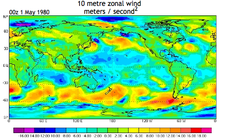
Surface observations are useful but scattered in space and time. It is difficult to compare results from a global climate model to scattered observations, and so a product called "reanalysis" is often used. Reanalysis uses observations and a model to create a dataset that is on a uniform grid in space and time. For example, the National Centers for Environmental Prediction (NCEP) has a reanalysis product that is available on a 1 degree latitude by 1 degree longitude grid every six hours from 1948 to the present. Some variables are also available on vertical levels (height levels from the ground up) throughout the atmosphere. The plot to the right was generated by data from the European Center for Medium-Range Weather Forecasts (ECMWF) reanalysis product. This particular field, zonal wind, is being used with other fields in the product to "drive" an ocean model. However, the fact that reanalysis uses a model adds some uncertainty to the product.
You can find information about these reanalysis products, and the data itself, at these links:
Next page -> model accuracy, continued
Links and resources
