|

|


How Does a GCM Work?
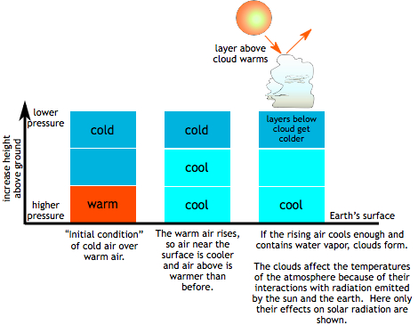
 If there is enough convection and condensation, clouds will form and it may
rain. Formation of clouds is usually represented by a change in cloud fraction
in each model level. The clouds cool the layers below them by reflecting
incoming solar
radiation, but they also warm those layers by trapping outgoing longwave
radiation that is
emitted by the earth.
Which effect wins depends on the height of the cloud, the time of day, and the air temperature where the cloud is. Each layer's temperature will be adjusted based on the warming and/or cooling effect of clouds (if they're present). Finally, new values for temperature, moisture, and wind speed can be determined for each layer and the model moves on to the next time step. The process continues.
Now, if we add neighboring grid cells, the same process occurs in each cell during each time step. When it is windy, heat and moisture are carried from one grid cell to the next!
Back to modeling topics
Links and resources
