
|

|


How Do Models Make Clouds?
for more advanced readers
WHAT'S STILL NEEDED?
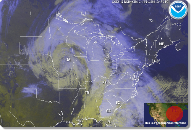 These are some of the more popular ways to represent the effects of clouds on a
grid cell. However, these schemes are far from complete representations of
clouds. Cumulus clouds themselves are small, but they can be organized into
large systems that span hundreds of miles like the NOAA GEOS satellite image
here. Current cloud
parameterizations do not take
into account these large-scale motions.
Also, cumulus convection is linked to the Earth's
boundary layer
but the parameterizations often overlook this important connection.
Third, these parameterizations represent deep convection (what you would
associate with a towering thunderstorm), but shallow convection is also very
important to the Earth's weather and climate. Examples of shallow convection
include the low clouds and fog common to the Californian coast. Clearly, there
is still a lot of work that needs to be done in representing clouds in climate
models. That is where CMMAP comes in!
To learn more about CMMAP's specific role in improving climate models,
take a look here!
Back to modeling topics
These are some of the more popular ways to represent the effects of clouds on a
grid cell. However, these schemes are far from complete representations of
clouds. Cumulus clouds themselves are small, but they can be organized into
large systems that span hundreds of miles like the NOAA GEOS satellite image
here. Current cloud
parameterizations do not take
into account these large-scale motions.
Also, cumulus convection is linked to the Earth's
boundary layer
but the parameterizations often overlook this important connection.
Third, these parameterizations represent deep convection (what you would
associate with a towering thunderstorm), but shallow convection is also very
important to the Earth's weather and climate. Examples of shallow convection
include the low clouds and fog common to the Californian coast. Clearly, there
is still a lot of work that needs to be done in representing clouds in climate
models. That is where CMMAP comes in!
To learn more about CMMAP's specific role in improving climate models,
take a look here!
Back to modeling topics
Links and resources
for more advanced readers
WHAT'S STILL NEEDED?
These are some of the more popular ways to represent the effects of clouds on a
grid cell. However, these schemes are far from complete representations of
clouds. Cumulus clouds themselves are small, but they can be organized into
large systems that span hundreds of miles like the NOAA GEOS satellite image
here. Current cloud
parameterizations do not take
into account these large-scale motions.
Also, cumulus convection is linked to the Earth's
boundary layer
but the parameterizations often overlook this important connection.
Third, these parameterizations represent deep convection (what you would
associate with a towering thunderstorm), but shallow convection is also very
important to the Earth's weather and climate. Examples of shallow convection
include the low clouds and fog common to the Californian coast. Clearly, there
is still a lot of work that needs to be done in representing clouds in climate
models. That is where CMMAP comes in!
To learn more about CMMAP's specific role in improving climate models,
take a look here!
Back to modeling topics
Links and resources
