This experiment simulates most accurately the temporal and spatial samplings of infrared (IR) and microwave (MW) brightness temperatures by NOAA-11 and NOAA-12 polar orbiters. The orbit of each satellite is spatially gridded onto the 4 deg. in latitude by 5 deg. in longitude horizontal resolution of the CSU CGM, and temporarily gridded onto the hourly time-step used for the radiative transfer model.
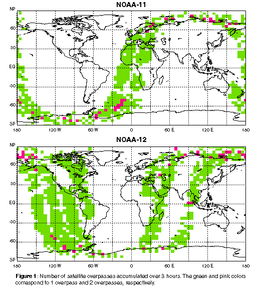
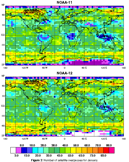
Figure 1 shows the number of satellite overpasses accumulated over 3 hours whereas Fig.2 shows the total number of overpasses in January. As seen in Fig. 2, the temporal sampling over the convectively
active regions in the tropics and the middle latitude storm track regions over the Pacific and Atlantic Oceans is less than that over the rest of the globe in January. This results because the radiative transfer model does not retrieve IR and MW brightness temperatures under cloudy skies which are most frequently seen in these regions.
January global maps of simulated brightness temperatures for the 7 IR channels and 4 MW channels averaged over the ascending and descending nodes of NOAA-11 and NOAA-12 are shown in the two tables below. The IR channels 2, 4, 6, and 8 are sensitive temperature whereas the IR channels 10, 11, and 12 are sensitive to water vapor. All four MW channels are sensitive to temperature.
NOAA-11
NOAA-12


