with some sample examples


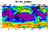
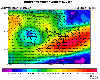
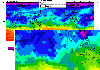
| Display of contoured data overlaid on maps. Data can either be gridded with lat/lon grids or with geodesic grids |
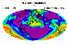
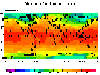
| Using different map projections to display contoured data. These projections are: Cylindrical Equidistant, Lambert's Equal Area, Mollweide, and Polar Stereographic. |
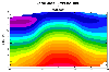
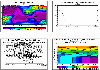
| Display of latitude-pressure cross sections of 3D data as well as latitude-height cross sections |
| Animate contours of a set of data and create an MPEG movie for the animation |
| Display of vector fields on top of a map and/or data contours |
| Display of pre-defined as well as custom selected regional plots |
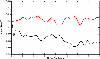
| Display of point-by-point data |

| Display of contoured data on top of a 3D globe with the ability to rotate and create an animation. |
| Display multiple plots in one page |